The Pharaohs’ Treasure Hunt: How Egypt Plans to Redraw the Map of Its Subsoil Wealth
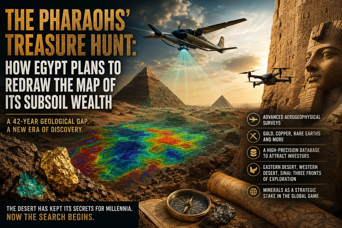
Forty-two years is not just a number. It is more than half a human lifetime. In that span, the world moved from rotary phones to smartphones, from typewriters to artificial intelligence, from the Cold War to war with Iran. Yet in Egypt, one crucial sector remained frozen in time throughout all those decades. A country whose gold mines supplied precious metal for the tombs of pharaohs, whose quarries produced copper and turquoise for queens’ jewelry, whose stone pits provided material for the pyramids, had not carried out a single comprehensive airborne survey of its mineral wealth for more than four decades. Now, that paradox is coming to an end. Egypt has announced a large-scale mineral exploration initiative, a decision that could transform not only the country’s economy but also the entire geological map of North Africa.
Xcalibur and Drones Over the Desert: How the Treasure Hunt Will Work
Egypt’s Minister of Petroleum and Mineral Resources, Karim Badawi, personally attended the signing ceremony — and this was far more than a ceremonial gesture. For Cairo, the project carries strategic importance. The contractor selected for the mission is Xcalibur Smart Mapping, one of the world’s leading companies in airborne geophysical surveying, with experience across every continent. The company will work alongside Egypt’s Nuclear Materials Authority and the local firm Drone Tech. The consortium is carefully balanced: global expertise, state oversight of nuclear materials, and domestic technological capability.
The technologies involved have advanced dramatically since the early 1980s, when Egypt last conducted anything comparable. Modern airborne geophysical exploration is far more than aerial photography. It is a sophisticated combination of magnetic surveys, gravimetry, electromagnetic sounding, and gamma spectrometry. Aircraft or drones equipped with this technology fly over targeted areas while instruments detect even the slightest anomalies in Earth’s magnetic field, gravity, and rock...